3/06/2014

Day #5—Cycle Monticello, UT to Moab, UT--May 27, 2011

54 miles by bike 

What a day! I was so tired when I arrived at the Moab Valley Inn that I left the bike in my room, and—unwashed and sweaty—immediately walked across the street to the Moab Brewery and had an icy draw at their bar. Moab is all about bikes—mountain bikes. And those that ride them are generally muscled, tattooed, young guys and gals. A greyhair on a road bike drinking beer at the local brewery drew some looks. I was hot and didn’t care a whit that I fit in like a square peg in a round hole. 


After my cooling brewski, I headed for the grocery, but got diverted by Gearheads Outdoor Store where I bought myself six additional tent pegs 
and a reading glasses lanyard. I remembered this store from when Jess and I were here in April of 2009 before we canoed the Green River. I even remembered that they had my kind of tent stakes. Right next door was the grocery, so I ducked in there and bought myself a tub of chicken salad at the deli and fixed myself a great spinach salad at the salad bar. Finally, I had all I needed, so headed back to the motel, but again got diverted at Moab Bicycles where I bought a lock for my bike. I’d forgotten the combination for my old one so it was useless. 

Back at the room I went through the ritual of all touring cyclists: eating, showering and washing out my bike clothes. Then what? I had no other clothes (duh!) so had to devise a sarong from the second bed sheet. Decked out like Caesar, I wolfed down my salads, called Jeff, and then took a long 
nap . . . so was up half the night writing these notes, watching inane things on TV, and thinking about tomorrow’s return ride. Felt fortunate that there was no fire drill or reason to leave the room before my clothes dried. 

Now, a little more about today’s ride: I left the Rodeway at about 7 AM, leaving my car with all my gear in it locked in the back parking lot. I wore my bike clothes, gloves, and helmet, of course, and also a fanny pack. I took my Specialized bike, which is equipped only with handlebar and underseat bags, thus spare tube etc were in the underseat bag, my lunch in the handlebar bag, and my wallet, phone, camera, etc. in the fanny pack. 


It was chilly—in the low 50s—when I left into a mild southwest tailwind. The tailwind died and the temp gradually rose into the high 70s by ride’s end. This doesn’t sound hot, but there is no shade or shelter anywhere. 


UT-191 into Moab is two-lane, switching to three lanes on the upside of hills, and there ARE hills—big ones! Yes, I know, I’m whining. I also know that hills usually have two sides, one up and the other down, but UT-191 was a lot hillier and a lot steeper than Google terrain had led me to believe. I figure that tomorrow I will have to climb two long sections (4 miles) of truck-on-a-cheese, twisty 6% downhill that I rode down today. Of course to get to the downhills I first had to climb. The first of these most exhausting climbs came after Church Rock, a huge sandstone gumdrop that sits all by itself in the sagebrush. The second was a twisting uphill just before and after Hole in the Rock (more on that later). This last one was shorter (only about a mile) and once I’d climbed it, I had a gentle roll the last 9 miles into Moab through Spanish Valley. 

Church Rock
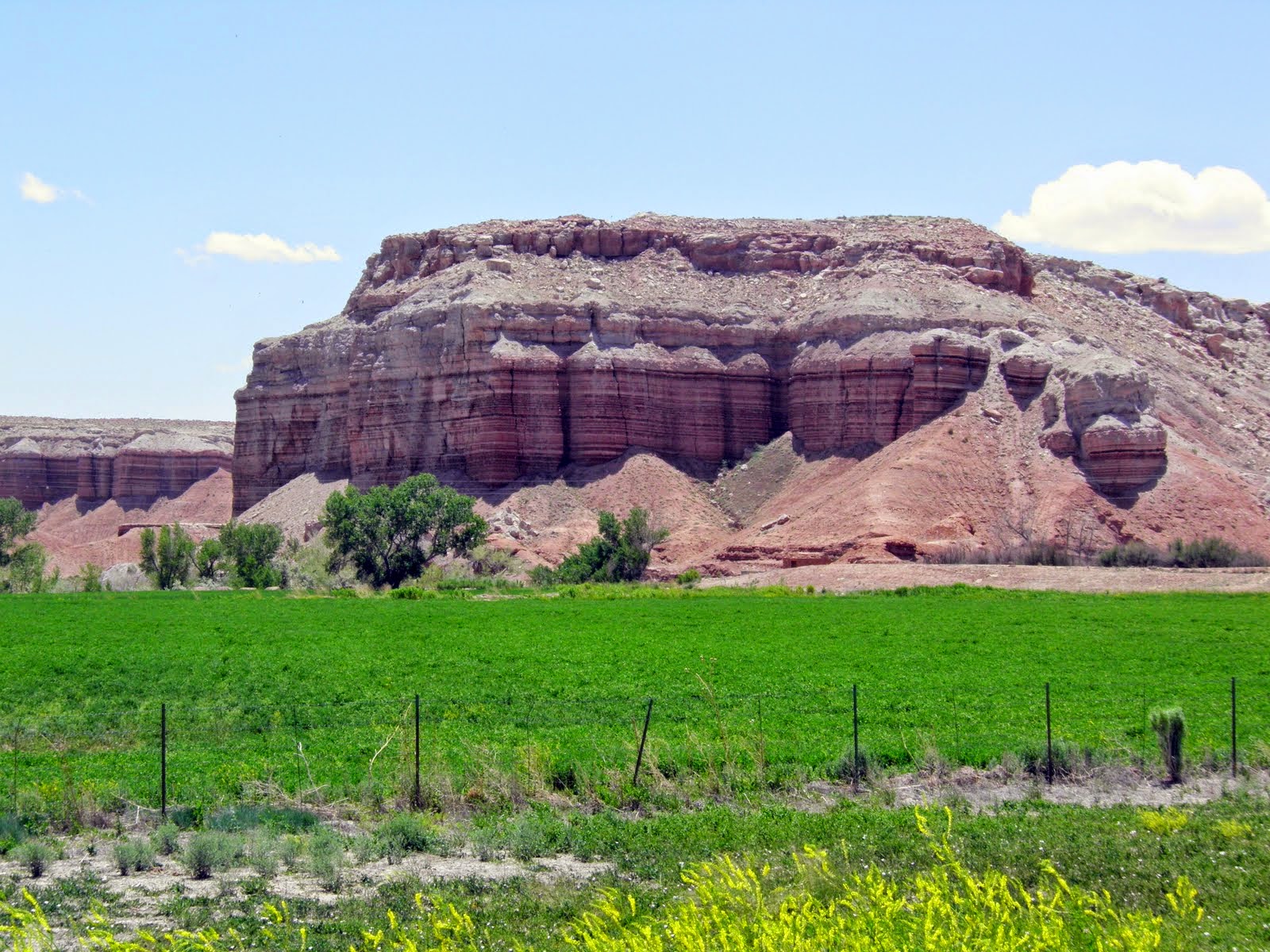
The landscape in this area is stunning. Huge rock formations, sage-dotted mesas, and the snow covered La Sal peaks always in the distance, as well as wildflowers at roadside. There was little traffic going north, so I did not have to contend with traffic when pedaling uphill and the shoulder disappeared to make a slow-vehicle lane. The road was rough paved blacktop with large stones, so I didn’t win any speed records going up or down, and generally those were my only choices. 
Clockwise: Lupine, Goldeneye, Blue Phacelia (Scorpion Weed) , Double Bladderpod
Wild Blue Flax (camera did not capture the blue color), Globe mallow, Utah Thistle?, Prickly Pear 
La Sal Mountains
Closer view of the LaSal Mountains and roadside flora
Right out of the motel parking lot, I had a short downhill and then a long uphill. Just when I was questioning my sanity, the road flattened out a bit and I began to enjoy the scenery. I stopped often to take pix and to catch my breath, and pushed my bike up a couple of steep spots. I liked to divert myself from climbing by finding shapes in the rock formations. I imagined giant crouching lizards, reclining dwarves, tall people wearing blankets (these lined the cliffs to the left as I entered Moab), humpbacked bison, and many parts of both the male and female anatomy. . . or I should say many representations of the same parts of the male and female anatomy. 


About 20 miles after Church Rock, I came to a turnout at the foot of a cliff that had a large arched “window” in it, reminiscent of those in Arches National Monument. I got off the bike and climbed up to take a photo. It was not easy going in bike shoes on the slick rock and sand.


Seeing nothing of civilization for 30 miles or so, I was delighted to come upon an alpaca farm, and then several miles further on, a touristy place called Hole in the Rock. I took a photo at the entrance to Hole in the Rock but did not go into the souvenir shop, because I saw a sign further up the hill that said “Rest Area 500 feet.” Yes! 


The rest area was fantastic. Huge cottonwoods, lush green grass, picnic tables, drink vending machines, and SHADE! I fixed myself slices of 
hard-boiled egg and cheese on Triscuits, bought 2 bottles of cold water and a can of lemonade, and sat at a picnic table cooling down for at least an hour, probably more. I figured that I was only about a dozen miles out of Moab, but I had no way of keeping track of my miles because the bottle cap I’d taped over my FlightDeck handlebar button had fallen off at mile 14-something at Church Rock. Without the bottle cap, I grip the handlebars to climb and inadvertently press the button and turn off the computer. 

After HITR, I had a climb and then the long gradual roll into Moab. Though I rode only 54 miles, it was a tough 54 miles, and I was exhausted when I finally arrived about 4 PM. I had been the whole day on my bike! I forgot to look at my average but it couldn’t have been much over 8 or 9 mph. Tomorrow I repeat the performance in the opposite direction. More tomorrow evening when I get back to my computer. 


I’ve not met anyone to really talk to all day, and it feels strange to be so estranged. 

3/05/2014

Day #6—Cycle Moab back to Monticello, UT--Sat May 28, Memorial Day Weekend

54 miles by bike 

I ate a fantastic breakfast at the Inn—scrambled eggs and sausage, fruit, yogurt, etc. I ate with two couples from Denver who were excited to be going jeeping that day. I guess I forgot to say that Moab is also famous for its jeeping, even having a jeeping festival in April. The jeeps, like the moun
tain bikes, delight in riding over the slick rock, up and down steep trails, and to the edges of the canyon rims. These couples (in their late 30s I’d guess) were going for an 8-hour jeep ride, but were still popping Ibuprophen after the previous day’s ride. 

Didn’t get out until 8 am or so. It was about 70F when I left, with a mild headwind, so I enjoyed the 9-mile ride back out through the valley, though there was a lot more traffic going south this Memorial Day Weekend. Came upon Hole in the Wall at mile 13 toward the end of the steep curving, downhill, and stopped briefly to catch my breath and buy more water. 


The traffic thinned before the long 3-mile climb, and for that I was grateful. Most had turned off for destinations in Canyonlands and elsewhere to spend their holiday. While climbing I was passed by only three vehicles: a tandem FedEx semi, a brand new turquoise semi cab piggybacking two other turquoise cabs, and a motorcyclist. 

Looking back at the disappearing shoulder at the top of the Hole in the Rock hill
Roadside rock jumble; not something one wants to be below on a bicycle
This gravelly rock was green but my camera did not capture it well; probably copper or some other mineral in the rock
Yeah! This time I am going d-o-w-n!
Just a reminder of what awaits one who needs to take a "green door" break at the side of the road
It was a long slog past Wilson’s Window and then to Church Rock at mile 39. The day was hotter and the headwind had picked up. By the time I reached Church Rock it was fierce! I looked it up on the computer when I got in, and learned that it was blowing from the south at 25 mph! Made the whole day feel like a long, hot, breathless climb. 
Here's a better pic of Wilson Rock taken on the way back to Monticello; I was on the opposite side of the road and climbed higher up


Much more fun to ride downhill on the way back to Monticello than up as on the way to Moab; that's the shaded rest area to the left


I am clean, rested, and fed now so shall send this off. Few new pix today as they would be the same as those I took yesterday, though I should have taken one of the motel. 

I’ll be camping for the next four nights, so there may be no report until I hit a Quality Inn at Lake Powell on June 2. Hope you all had and are having a great Memorial Day Weekend. 


Peter & Sonja: Try to keep your heads above water! Hard to think of Vermont mud season when it is so dry out here. 

3/04/2014

Day #7— Singletree CG south of Torrey, UT—Sunday, May 29, 2011

I’m wrung out after my RT ride to Moab. Got off about 8 after a meager breakfast of cereal and coffee. Took two hardboiled eggs from the breakfast buffet for camping fare. The wind was so fierce this morning that the guy behind the front desk had to help me open the door against it. By the time I had the car repacked and was on my way, my teeth were gritty with sand. The wind is turning the sky pink with sand, and things in the distance are hazy or indistinguishable. Had the wind been this savage yesterday I would have been unable to get back to Monticello from Moab. As it was, it was an exhausting experience, causing me to fall out of love with my bike for the time being. 

I headed south on 191 to Blanding, which advertises itself as “The Gateway to Adventure,” and that it is. Blanding is a small town with one main street a Fattboyz Grillin’ restaurant, and the orange barrels of roadwork. Seems as though they are replacing about 5 miles of 191 through the town.


My first stop was at Butler Wash Indian Ruins. I hiked back about half a mile over slickrock to the canyon rim. On the other side, high in the canyon wall, was a ruin tucked under the cliff overhang ala Mesa Verde but on a much smaller scale. The site was said to have been occupied by the Basketmakers (2500-1200 years ago). 


Slick rock on way back to Butler Wash
Butler Wash Indian Ruins tucked up on the far side of the canyon
Next I stopped at Natural Bridges National Monument. One can hike down into the canyon, but in my wrung out state, I chose instead to drive a 9-mile loop and take short walks to the canyon’s edge where I could see the bridges. The first stop on this loop was Horse Collar Ruin. More Mesa Verde-type dwellings.


The way I could capture the site with my camera
A closer view of Horse Collar Ruins from the Internet
The bridges are huge rock arches cut by the White River that runs through the canyons. When one says “river” out here, think creek. The canyon bottom was green with trees and plants because of this small stream, however. There was one loaded touring bicycle parked off the road near a trail to the canyon  bottom. I was just as happy that my original plan to bicycle to Sarah's had turned into a road trip.


The first bridge was Sipapu Bridge in Deer Canyon. It was the most photogenic. Then I stopped at Kachina in White Canyon. I walked to the lookout to see this bridge and couldn’t find it. After a bit my eyes adjusted and I could see it, but it blended so well with the other formations that it 
reminded me of the bridge in Raiders of the Lost Ark that appeared only after Indy had thrown sand on it. The last bridge was Owachomo in Armstrong Canyon. It was at a poor angle to the observation point and could not be seen or photographed well, so I pulled a photo from the Internet. Those who hiked down to the canyons probably had a much better feel for the enormous size of these bridges.

Sipapu Bridge
Kachina Bridge
Owachomo Bridge--this pic from the Internet as I could not get a good shot of it
There were interesting swirly rock formations around Sipapu Bridge, several looking to me as though Paul Bunyan's ox had passed this way.


My next stop was in a canyon where there were petroglyphs. They were high up on the canyon’s red wall and one wondered at how the topography had changed over the years. A part of the wall had fallen and the petroglyphs with it.

What could the rectangular figure with feet and rabbit ears represent? An end table with a plant on it? Just kidding.
I drove through Capitol Reef National Park where one feels flea sized by the hugeness of it all. The rock formations are all different colors from green to gray to maroon. One area looked like giant gravel piles but was volcanic ash turned to solid rock. In CRNP, the rock walls and formations all seemed to be tilted. I think I may have to take a course in geology to understand better how these areas were formed. 


The Cheesebox

Jacob's Chair


Close up of the layered walls of this formation
What looks like a quarried gravel pile, is actually petrified volcanic ash
Don't know what mineral caused the maroon lines through this formation
Oh, to have a geologist on hand!

I saw similar "ice cream" formations on entering Zion National Park; some of them were petrified sand dunes I think

The road ran directly through this formation
The French puff curtains left after the road crew cut through the formation
I crossed over the end of Lake Powell fed by Dirty Devil Creek at this end and then through Glen Canyon National Recreation Area and Fruita a small town with one orchard that I could see.
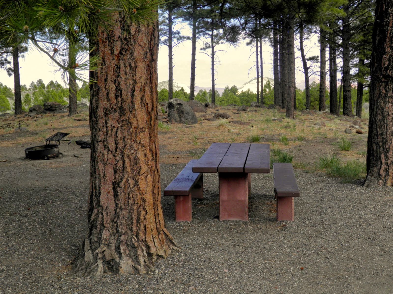

When I got to where I thought I’d camp—an RV park in Torrey with showers and a laundry—it looked so sorry that I drove past and into the Dixie National Forest to camp at Singletree CG at the foot of the pass. 


Singletree was a beautiful campground in the Ponderosa pines—a change from the arid rocks and scrub I’d driven through all day. The CG had flush toilets but no washroom or showers, just spigots near each campsite. 


Nonetheless, I loved the campsite and struggled to set up the tent and place it behind a big Ponderosa Pine to protect it a bit from the wind. I opened my folding chair thinking to sit in it and write my journal after dinner, but it blew away after I had taken only one pic of my tent, so I had to stash it.


The campground host assured me that the wind would die down, but that was not to be. The wind has been howling all day, buffeting the car and stirring up sand. Each time I got out of the car, I expected to see the paint scoured off. 

View through the trees at the front of my campsite
I decided to have spaghetti for dinner and set up my kitchen. Tough going with my pots and pans blowing off the picnic table and the stove blowing out. Finally I had a little boiling water, but decided to use it on some instant fare I was carrying, so had white bean & pasta soup instead of spaghetti. It was only half cooked because the water cooled so fast. Pretty yukky.

It was cold in the pines, and to protect myself from the cold and wind I put on every item of clothing that I own (nearly), weighted the tent stakes with rocks, and sat in the car at the campground to read until dark. Then I got into the tent—even bringing in the old bike quilt—and lay there until about 11 PM, freezing and thinking that the tent was going to blow away. The wind was so strong that it kept bending the tent down on top of me. 


Finally, I got up and hauled my sleeping bag and blankets to the car. No wonder I was cold. Light snow was illuminated by my headlamp—blowing sideways—and when I turned on the car to see the temperature it was 31 degrees F. Though wrapped in my sleeping bag and quilt, I sat slumped in the driver’s seat all night. In order to lie down, I would have had to empty the bike and all the gear out of the back and had no place to put it. Terrible night's “sleep.” 


My ultra-light mesh tent is for bike touring. Neither it or my sleeping bag is 
designed for cold weather. 

Storm clouds and snow in the Dixie National Forest where I camped at Singletree Campground. It was extremely windy and cold, the nighttime temp dropping to 31F at the campsite and 27F higher up the mountain. Spent an uncomfortable night huddled and cold in the car.