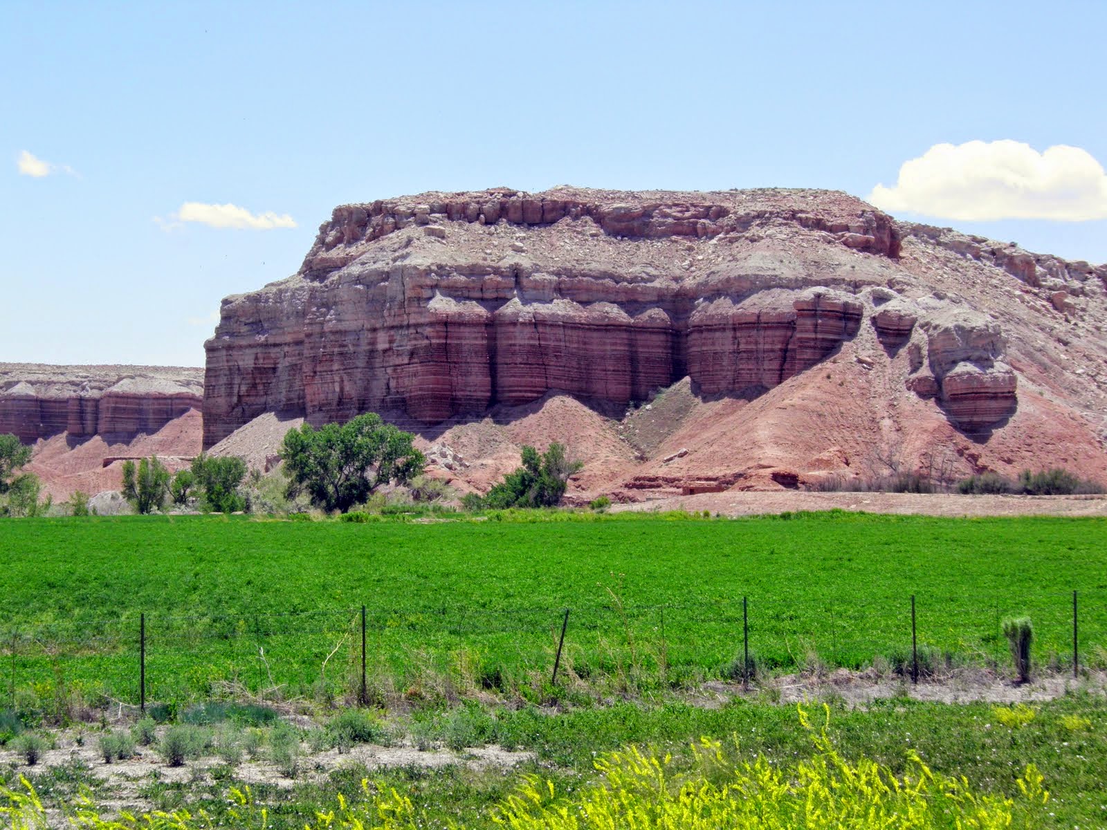
I’m wrung out after my RT ride to Moab. Got off about 8 after a meager breakfast of cereal and coffee. Took two hardboiled eggs from the breakfast buffet for camping fare. The wind was so fierce this morning that the guy behind the front desk had to help me open the door against it. By the time I had the car repacked and was on my way, my teeth were gritty with sand. The wind is turning the sky pink with sand, and things in the distance are hazy or indistinguishable. Had the wind been this savage yesterday I would have been unable to get back to Monticello from Moab. As it was, it was an exhausting experience, causing me to fall out of love with my bike for the time being.
I headed south on 191 to Blanding, which advertises itself as “The Gateway to Adventure,” and that it is. Blanding is a small town with one main street a Fattboyz Grillin’ restaurant, and the orange barrels of roadwork. Seems as though they are replacing about 5 miles of 191 through the town.
My first stop was at Butler Wash Indian Ruins. I hiked back about half a mile over slickrock to the canyon rim. On the other side, high in the canyon wall, was a ruin tucked under the cliff overhang ala Mesa Verde but on a much smaller scale. The site was said to have been occupied by the Basketmakers (2500-1200 years ago).
 |
| Slick rock on way back to Butler Wash |
 |
| Butler Wash Indian Ruins tucked up on the far side of the canyon |
Next I stopped at Natural Bridges National Monument. One can hike down into the canyon, but in my wrung out state, I chose instead to drive a 9-mile loop and take short walks to the canyon’s edge where I could see the bridges. The first stop on this loop was Horse Collar Ruin. More Mesa Verde-type dwellings.
 |
| The way I could capture the site with my camera |
 |
| A closer view of Horse Collar Ruins from the Internet |
The bridges are huge rock arches cut by the White River that runs through the canyons. When one says “river” out here, think creek. The canyon bottom was green with trees and plants because of this small stream, however. There was one loaded touring bicycle parked off the road near a trail to the canyon bottom. I was just as happy that my original plan to bicycle to Sarah's had turned into a road trip.
The first bridge was Sipapu Bridge in Deer Canyon. It was the most photogenic. Then I stopped at Kachina in White Canyon. I walked to the lookout to see this bridge and couldn’t find it. After a bit my eyes adjusted and I could see it, but it blended so well with the other formations that it reminded me of the bridge in Raiders of the Lost Ark that appeared only after Indy had thrown sand on it. The last bridge was Owachomo in Armstrong Canyon. It was at a poor angle to the observation point and could not be seen or photographed well, so I pulled a photo from the Internet. Those who hiked down to the canyons probably had a much better feel for the enormous size of these bridges.
 |
| Sipapu Bridge |
 |
| Kachina Bridge |
 |
| Owachomo Bridge--this pic from the Internet as I could not get a good shot of it |
There were interesting swirly rock formations around Sipapu Bridge, several looking to me as though Paul Bunyan's ox had passed this way.
My next stop was in a canyon where there were petroglyphs. They were high up on the canyon’s red wall and one wondered at how the topography had changed over the years. A part of the wall had fallen and the petroglyphs with it.
 |
| What could the rectangular figure with feet and rabbit ears represent? An end table with a plant on it? Just kidding. |
I drove through Capitol Reef National Park where one feels flea sized by the hugeness of it all. The rock formations are all different colors from green to gray to maroon. One area looked like giant gravel piles but was volcanic ash turned to solid rock. In CRNP, the rock walls and formations all seemed to be tilted. I think I may have to take a course in geology to understand better how these areas were formed.
 |
| The Cheesebox |
 |
| Jacob's Chair |
 |
| Close up of the layered walls of this formation |
 |
| What looks like a quarried gravel pile, is actually petrified volcanic ash |
 |
| Don't know what mineral caused the maroon lines through this formation |
 |
| Oh, to have a geologist on hand! |
 |
| I saw similar "ice cream" formations on entering Zion National Park; some of them were petrified sand dunes I think |
 |
| The road ran directly through this formation |
 |
| The French puff curtains left after the road crew cut through the formation |
I crossed over the end of Lake Powell fed by Dirty Devil Creek at this end and then through Glen Canyon National Recreation Area and Fruita a small town with one orchard that I could see.
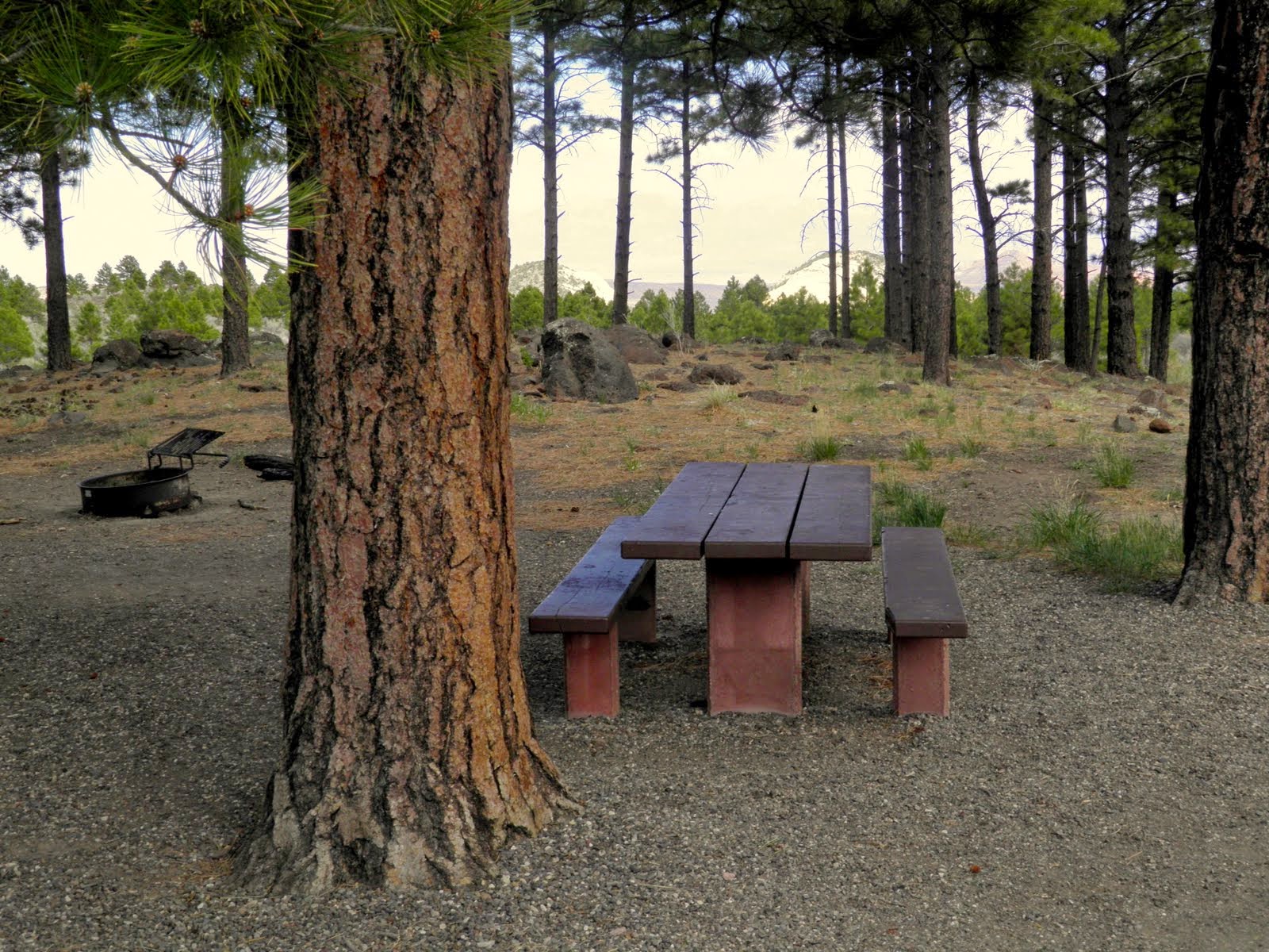
When I got to where I thought I’d camp—an RV park in Torrey with showers and a laundry—it looked so sorry that I drove past and into the Dixie National Forest to camp at Singletree CG at the foot of the pass.
Singletree was a beautiful campground in the Ponderosa pines—a change from the arid rocks and scrub I’d driven through all day. The CG had flush toilets but no washroom or showers, just spigots near each campsite.
Nonetheless, I loved the campsite and struggled to set up the tent and place it behind a big Ponderosa Pine to protect it a bit from the wind. I opened my folding chair thinking to sit in it and write my journal after dinner, but it blew away after I had taken only one pic of my tent, so I had to stash it.
The campground host assured me that the wind would die down, but that was not to be. The wind has been howling all day, buffeting the car and stirring up sand. Each time I got out of the car, I expected to see the paint scoured off.
 |
| View through the trees at the front of my campsite |
I decided to have spaghetti for dinner and set up my kitchen. Tough going with my pots and pans blowing off the picnic table and the stove blowing out. Finally I had a little boiling water, but decided to use it on some instant fare I was carrying, so had white bean & pasta soup instead of spaghetti. It was only half cooked because the water cooled so fast. Pretty yukky.
It was cold in the pines, and to protect myself from the cold and wind I put on every item of clothing that I own (nearly), weighted the tent stakes with rocks, and sat in the car at the campground to read until dark. Then I got into the tent—even bringing in the old bike quilt—and lay there until about 11 PM, freezing and thinking that the tent was going to blow away. The wind was so strong that it kept bending the tent down on top of me.
Finally, I got up and hauled my sleeping bag and blankets to the car. No wonder I was cold. Light snow was illuminated by my headlamp—blowing sideways—and when I turned on the car to see the temperature it was 31 degrees F. Though wrapped in my sleeping bag and quilt, I sat slumped in the driver’s seat all night. In order to lie down, I would have had to empty the bike and all the gear out of the back and had no place to put it. Terrible night's “sleep.”
My ultra-light mesh tent is for bike touring. Neither it or my sleeping bag is designed for cold weather.
Storm clouds and snow in the Dixie National Forest where I camped at Singletree Campground. It was extremely windy and cold, the nighttime temp dropping to 31F at the campsite and 27F higher up the mountain. Spent an uncomfortable night huddled and cold in the car.


No comments:
Post a Comment